I’m trying to better understand this emerging fishing pattern — and I'd love to hear from people who've actually seen it in action.
Something interesting is showing up in vessel-tracking data, and I think the people best placed to explain it are those out on the water or those who manage them.
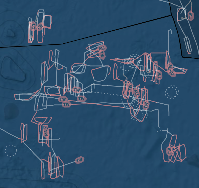
More and more, I’ve been observing in the WCPO longline fleet a change in the traditional manoeuvring pattern from parallel straight lines to an almost rectangular overlapping pattern

And I have been asked to have a look at this and the potential it may have on the way we monitor LL fisheries and its impacts on CPUE
One of the explanations I’ve been asked to take a closer look at is what's being called "double setting" — a more complex setting pattern that some longline vessels appear to be using within a single fishing operation.
From what we've been able to piece together and out of one the theories, the sequence seems to go roughly like this:
Set the first line
Begin hauling it
Cut it in half mid-haul
Set the second line
Haul the second line in full
Go back and haul the remainder of the first set
A similar thing is that they set out the line with X baskets, then haul only half of them, 1/2 X , cut the mainline and join/connect another new set and set maybe ½ X baskets again, basically expanding the number of hooks by 50%

The result, when you look at it, is a pattern of overlapping rectangles. It's visually distinctive, which is partly why it's starting to catch our attention in vessel-tracking data.
So why does this matter?
These kinds of manoeuvres are becoming increasingly visible in monitoring systems, and they raise some genuinely interesting questions about how fishing effort and catch data get captured.
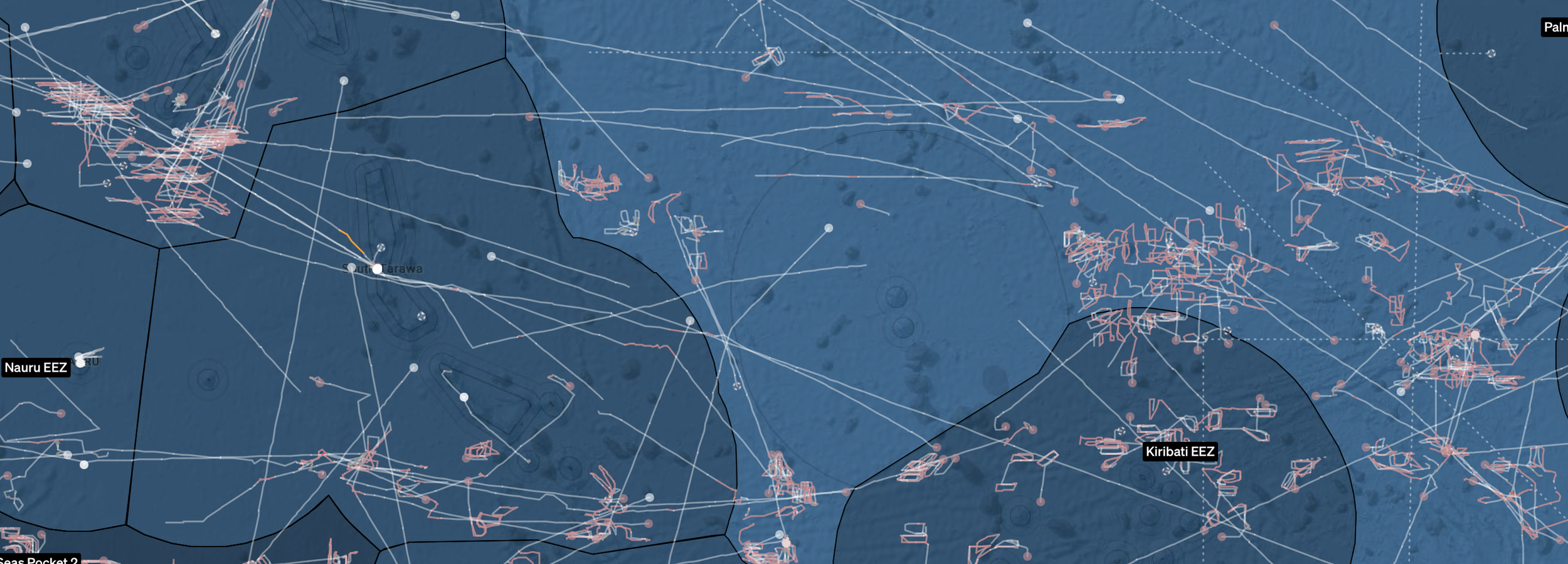
As you see below, other h than the RMI-based fleet (upper left corner) that fishes in the standard parallel and coordinated among vessels of the same company style, the rectangle way is taking over on other EEZ and HS.
When a vessel conducts a complex, interleaved set-and-haul sequence like this, how well does a traditional logsheet capture this? To answer that, I’d like to understand the reasons and logistics of the manoeuvring.
Getting this right matters, not to create more paperwork for anyone, but because regional monitoring standards need to keep pace with how fishing is actually done out there. If the data doesn't reflect modern operations, it doesn't serve anyone well.
Here's where I love your help if you know more about this
Has been a long time since I was on the bridge of an operation longliner, so I may be seeing this with old eyes; hence, I’m at the early stages of trying to understand this properly — which means what I need most right now isn't large volumes of data. I’m after examples and operational insight.
Specifically, I’m curious about:
How these operations actually play out in practice on the water
How skippers and crew sequence the deployments and hauling activities
How vessels typically record what they've done in the official logsheets, with, or under EM
Have you seen this? Have you done this? Does the description above match something you recognise, or does it miss the mark in ways that would be useful to flag?
I’m genuinely keen to hear from skippers, crew, observers, fishing companies, anyone with a window into how these operations work on the water. Anything shared will be treated confidentially and used solely to improve my understanding of current fishing practices.
So yeah… if you've got ideas, stories, or just a hunch about how this works — I’m more than happy to hear them.
Reach out directly at franciscoblaha(at)mac.com. Thank you.
Disclaimer: No confidential information is being disclosed; all these images are from Starboard.nz, which is the platform I work on most, but they will be visible to anyone on other platforms, such as GFW or Skylight.